🌿 Mapping Wetlands with Terrain Derivatives and U-Net

A scalable, deep-learning workflow for wetland detection — built with SWEEP and open terrain data.
🔍 Why Wetlands, Why Now?
Wetlands are powerful carbon sinks, water filters, and biodiversity hotspots — yet mapping them remains a challenge. Optical imagery can be obscured by cloud cover or forest canopies, and field surveys are costly and time-consuming.
What if we could detect wetlands just from terrain?
This project builds a fully automated deep-learning workflow that uses topographic derivatives (slope, curvature, TPI, etc.) as inputs to a U-Net model, enabling wetland prediction across large regions — no satellite imagery required.
⚙️ Workflow Overview
This workflow is built using the SWEEP engine — a multi-cloud orchestrator for Earth data workflows.
🛠️ Steps:
- fn_read_hucs: Load list of HUC12 watershed IDs
- fn_fetch_stacks: Generate and upload multiband terrain stack
- predict_huc: Run patch-wise inference using U-Net model from Hugging Face
- mosaicpredictions: Combine all per-HUC masks into one seamless raster
🧠 Model Architecture
We use a U-Net with ASPP (Atrous Spatial Pyramid Pooling), trained on stacked rasters representing:
- Slope
- TPI
- Curvature
- Elevation
Training is patch-based (128×128), with BCE + Dice loss, and inference is streamed over each HUC tile.
Weights are published on Hugging Face: dotmotelabs/Unet-ASPP
📊 Performance
Trained on manually aligned wetland masks (NWI-aligned), evaluated on hold-out watersheds:
| Metric | Value (± SD) |
|---|---|
| mIoU | 0.73 ± 0.06 |
| F1 Score | 0.84 ± 0.05 |
| Precision | 0.88 ± 0.04 |
| Recall | 0.81 ± 0.07 |
Even without spectral imagery, terrain features alone provide strong predictive power.
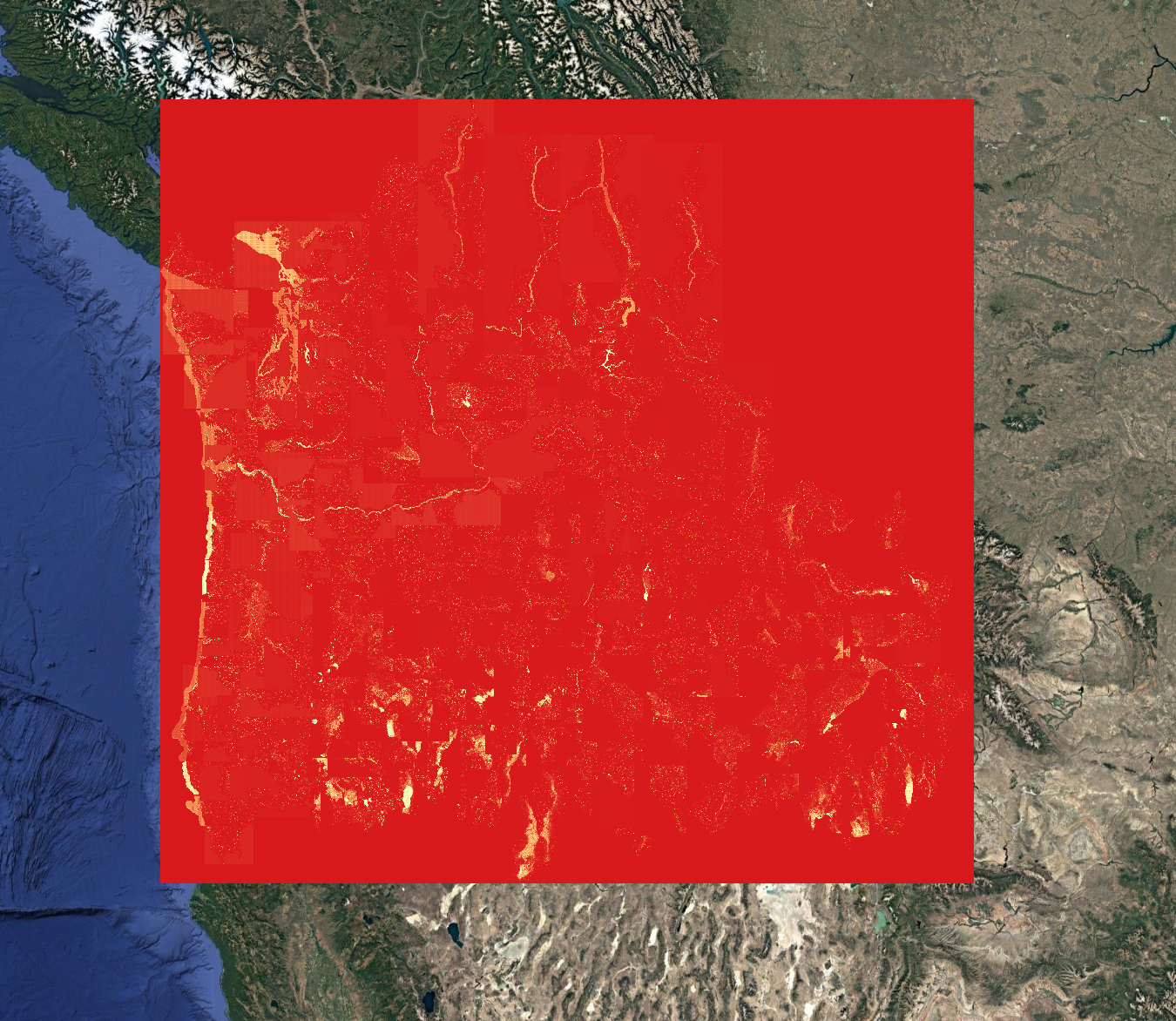
🖼️ Example Output
Here's the predicted wetland mask for a HUC12 in the Pacific Northwest:
🌐 What's Next
We're integrating:
- 🛰️ Multi-sensor fusion (NDVI, Sentinel-1 SAR)
- 🌍 Cross-regional generalization
- 🤖 Agent Earth AI workflows
Want to try it on your watershed? Want to contribute your own wetland labels or features?
📬 Contact us — or open an issue on GitHub.
🔗 Links
- 🔧 GitHub: https://github.com/SWEEP-Inc/sweep-wetlands/
- 🤗 Model: Hugging Face U-Net Weights
🙌 Acknowledgments
Built by DotMote Labs
Special thanks to contributors working on hydrology, terrain, and climate-resilient mapping.